
Szlak Piastowski. U źródeł polskości. Pr...
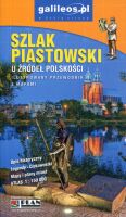
Szlak Piastowski. U źródeł polskości. Przewodnik 144 strony w kolorze formatu 11 x 19 cm. Bogato ilustrowany przewodnik po miejscach gdzie rodziła się państwowość polska. Liczne mapy i plany. Oprawa miękka, broszura klejona. Studio PLAN, wyd. V, Wrocław 2023 ISBN 978-83-7868-835-8...
Izery (Góry Izerskie). Ilustrowany przew...
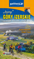
Sandra Nejranowska Izery (Góry Izerskie). Ilustrowany przewodnik z mapami 80 stron 11 x 19 cm w pełnym kolorze bogato ilustrowanych, w tym atlas Gór Izerskich w skali 1:35 000. Wydawnictwo Turystyczne PLAN, wyd. III, Jelenia Góra 2021 ISBN 978-83-7868-669-9...
Rudawy Janowickie. Ilustrowany przewodni...
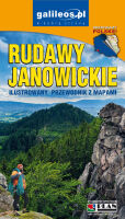
Marcin Papaj, Piotr Norko Rudawy Janowickie. Ilustrowany przewodnik z mapami 60 stron 11 x 19 cm w pełnym kolorze bogato ilustrowanych, w tym atlas Rudaw Janowickich w skali 1:30 000. Wydawnictwo Turystyczne PLAN, wyd. III, Jelenia Góra 2022 ISBN 978-83-7868-709-2...
Drezno. Miśnia. Ilustrowany przewodnik z...
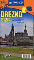
Marcin Papaj Drezno. Miśnia. Ilustrowany przewodnik z mapami 60 stron 11 x 19 cm w pełnym kolorze, bogato ilustrowanych, w tym plan śródmieścia Drezna w skali 1:10 000. Wydawnictwo Turystyczne PLAN, wyd. V, Jelenia Góra 2017 ISBN 978-83-7868-391-9...
Szlak Piastowski. U źródeł polskości. Pr...
Szlak Piastowski. U źródeł polskości. Przewodnik 144 strony w kolorze formatu 11 x 19 cm. Bogato ilustrowany przewodnik po miejscach gdzie rodziła się państwowość polska. Liczne mapy i plany. Oprawa miękka, broszura klejona. Studio PLAN, wyd. IV, Wrocław 2020 ISBN 978-83-7868-494-7...
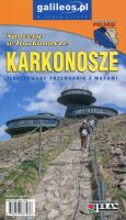
Karkonosze. Ilustrowany przewodnik z map...
Karkonosze. Ilustrowany przewodnik z mapami 156 stron 11 x 19 cm w pełnym kolorze bogato ilustrowanych. Atlas Karkonoszy w skali 1:30 000. Wydawnictwo Turystyczne PLAN, wyd. XIII, Jelenia Góra 2023 ISBN 978-83-7868-798-6...
Rafał Fronia Zamość. Multiprzewodnik 60 stron w kolorze formatu 11 x 19 cm. Przewodniczek bogato ilustrowany, liczne mapki i planiki w różnej skali. Oprawa miękka, broszura klejona. Studio PLAN, wyd. III, Wrocław 2021 ISBN 978-83-7868-653-8...
Góry Stołowe i Adršpašsko-Teplické Skalý...
Jacek Potocki Góry Stołowe i Adršpašsko-Teplické Skalý. Ilustrowany przewodnik z mapami 120 kolorowych stron formatu 11 x 19 cm. Atrakcje turystyczne i przyrodnicze, aktualne przebiegi szlaków pieszych, rowerowych i konnych. Ukształtowanie terenu pokazano przy pomocy warstwic o cięciu co 10 m. Siatka geograficzna zgodna z GPS oparta na układzie WGS-84. Informacje praktyczne. Studio PLAN, wyd. VII, Jelenia Góra 2022 ISBN: 978-83-7868-752-8...
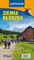
Ziemia Kłodzka. Ilustrowany przewodnik z...
Jan Zasępa Ziemia Kłodzka. Ilustrowany przewodnik z mapami 144 strony w kolorze formatu 11 x 19 cm. Przewodniczek bogato ilustrowany, liczne mapki i planiki w różnej skali. Oprawa miękka, broszura klejona. Studio PLAN, wyd. VII, Wrocław 2024 ISBN 978-83-7868-834-1...
Drezno. Miśnia. Ilustrowany przewodnik z...
Marcin Papaj Drezno. Miśnia. Ilustrowany przewodnik z mapami 60 stron 11 x 19 cm w pełnym kolorze, bogato ilustrowanych, w tym plan śródmieścia Drezna w skali 1:10 000. Wydawnictwo Turystyczne PLAN, wyd. VI, Jelenia Góra 2024 ISBN 978-83-7868-886-0 ...













 Polish